About Coastline UAV


Woman Owned & Managed
Coastline UAV is a woman owned small business specializing in aerial drone photography with particular attention to industrial applications. Our inspection capabilities are second to none offering a wide range of visual and thermal imaging. Our company is made up of professional’s in engineering, photography, computer science, and FAA certified pilots all working together to provide a one stop shop for all of your inspection and compliance based needs.
Working with our Real Estate Partners
We also work alongside professionals in the real estate market representing not only the interests of the seller, but those of the buyer. In today’s real estate market so many homes are now equipped with solar panel installations and the only way for a buyer to know if those panels are really working and producing effectively is to scan them with a capable thermal imaging drone. Our ultra high resolution grid roof inspection offers the buyer a birds eye view of every square inch of the roof with amazing detail. Places where no inspector goes.
State Of The Art Equipment
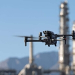
Coastline UAV uses only the newest state of the art drone equipment capable of incredible resolution, zoom capability and the highest resolution thermal imaging available on the market today. Our drones can fly hundreds of feet from a target and read serial numbers on equipment, detect rust and see cracks and defects in structure without risking the asset while performing the inspection. With high resolution imaging on the ground, our customers can see and direct the inspection on a high resolution TV monitor on the ground. You are seeing real time images and our customers can direct the inspection and specify additional photographs and videos as the inspection progresses.
Construction Site Specialists
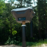
Construction sites have unique challenges. Our equipment can produce centimeter level accuracy for elevation maps, latitude and longitude for positioning, and centimeter measurement accuracy. We place ground control points and using our advanced GNSS equipment and Coastline UAV owned base NTRIP base station for real time corrections, we can provide accuracy unappareled in the industry. Our professionals can give our construction customers detailed elevation maps withing 24 hours, on demand, whenever they need it. We also provide asset management. Need to know where your constructions materials are going? No problem. How about how much dirt is piled up along side the site, accurate to the one cubic foot? Not a problem for our crew and equipment.

